|
CESN/CRWA Charles River Bacteria Forecasting
|
||||
|
Investigators:
Over the last several years, the Charles River Basin has been safe for all recreational activities 80-90% of the time. However, the river still can't safely be used for swimming due to a lack of accurate and trusted predictions of the bacterial water quality. We have installed an environmental data monitoring station in the Charles River near Community Boating, which will automatically feed data to an online water quality forecasting system developed by CESN in collaboration with the Charles River Watershed Association (CRWA). This data station measures water temperature, air temperature, rainfall, and wind speed (among other data), and the data is incorporated in a regression model that has been used by CRWA to generate predictions of E.coli bacteria concentrations in the Charles River basin. CRWA has developed a system of blue and red flags, designating whether or not the water presents a health risk for boaters. The goal of this project is to automate this system so that it runs 7-days per week and is based on local data from the basin.
The original prototype model developed by CRWA provided daily predictions of E.coli concentrations that have been demonstrated to have a 90% accuracy for blue and red flagging (safe for boating vs. potential health risk). However, the model required manual data collection and manipulation, so it was only available 5 days per week, and it was based on weather data from Logan Airport, which is relatively far from the Charles River basin. This project will attempt to increase the accuracy and reliability of these water quality predictions by placing a data collection station directly in the Charles River basin, and by creating the ability to automatically assimilate the data in the model 7 days per week. The station will also provide water temperature data, which should be more relevant than the air temperature that was originally used. 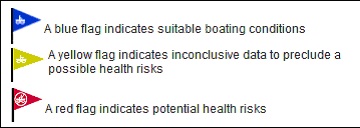 The data collection station has been installed on an island near Community Boating, in the epicenter of the rivers water-based recreational activity. The station will collect wind direction, wind speed, air temperature, rainfall, PAR, barometric pressure, and water temperature. This data will be sent to the Internet using cell phone technology, and the water temperature, rainfall, and wind speed will be assimilated into an online model to automatically generate blue and red flags 7 days per week. The raw data from the data station is also being made available in real time to the public through the CESN Live Data links. 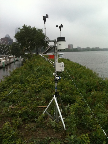 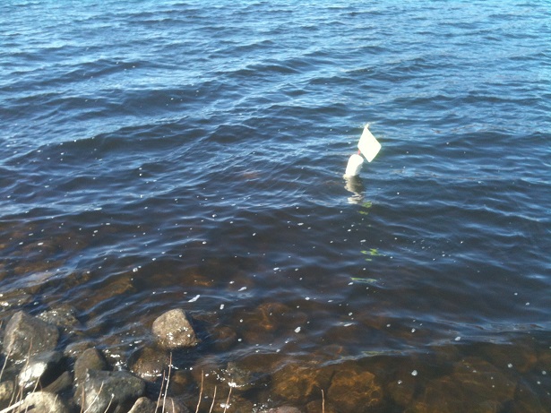 This project was made possible thanks to support from Community Boating, MA Department of Conservation and Recreation, the Boston Conservation Commission, and the MA Natural Heritage Program. Wollaston Beach Marine Bacteria Forecasting
Investigators:
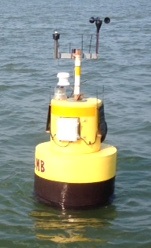
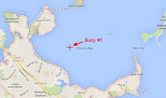
Prompted by the initial success of the Charles River project, we decided to test the same concept on a marine beach. According to EPA guidelines, in salt water the bacteria Enterococcus is used as an indicator of pathogenic water quality, instead of E.coli, but otherwise the objective is the same. We have installed a buoy in Quincy Bay near Wollaston Beach which collects water temperature, salinity, and turbidity, among other variables. Just like the Charles River station, the buoy transmits the collected data to our servers every hour providing near real-time access to the data. We also gather rainfall and wind speed and direction in real time from a weather station at UMass Boston and tide height data from the NOAA Boston tide gauge. This data is automatically processed every two hours and used to update an online model of Enterococcus forecasts. This model was originally created using regression analysis and publicly available historical hydro-meteoroligical variables. It indicated that the key explanatory variables for Enterococcus at Wollaston Beach are rain, windspeed, wind direction, tide height, water temperature, and salinity. We intend to create a new model at the end of the 2013 swimming season based on our newly collected higher frequency data.
  This project was made possible thanks to support from the City of Quincy and the Quincy Marine Police, the MA Department of Conservation and Recreation, Save the Harbor/Save the Bay, the US EPA, and Mass BayKeeper Inc. |
||||
|
|
||||